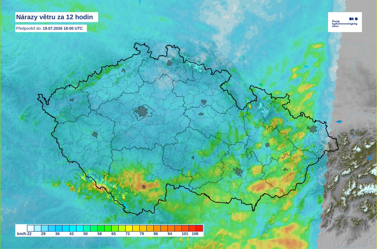
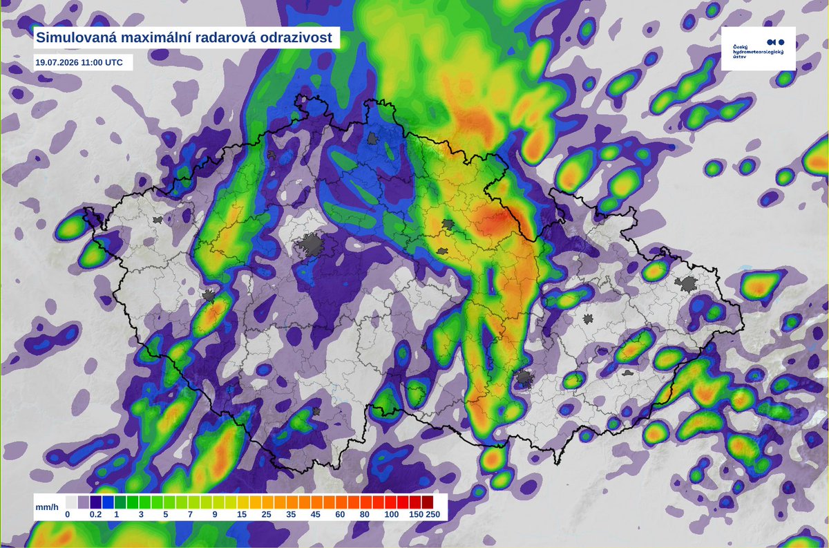
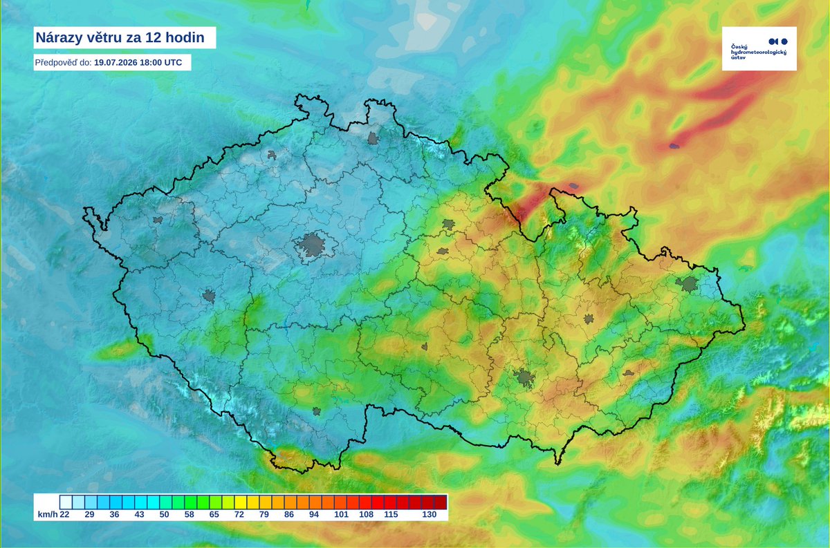
🌩❗Current view of tomorrow’s potentially dangerous storm situation. Through the eyes of two high-resolution models. ➡At this moment (approx. 12 hours before the formation of the storms themselves) it is still not clear where a possible storm (convective) system will form and what its trajectory will be. It is also possible that several of these more linear systems will appear. ➡While the ICON D2 model (the first two maps) predicts the impact of mainly the southern regions of Bohemia, Vysočina, Moravia and Silesia, the Aladin model (the last two maps) predicts progress to the eastern parts of Bohemia, to the north of Moravia and to a greater extent to Silesia. ❓This uncertainty is completely normal in these situations, but it is important to see the consistency in that the main risk will be strong wind gusts, which can be more extensive (wider). Current data also indicates a likely increase in the alert level tomorrow morning, but we’ll see. 👉The ICON D2 model also indicates, in addition to a possible larger system, the formation of more isolated thunderstorms (probable supercells) that can bring even larger hail. 👉Watch for an update of any warning tomorrow during the morning. For now, we wish you a peaceful evening. #KonvektivniSkupina